The PAGEOS project at Palmer Station
|
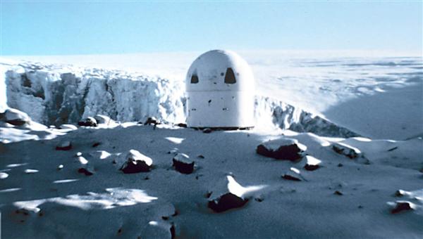
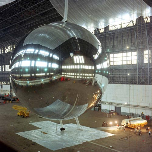
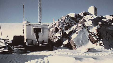
Above, in the backyard of Palmer Station in 1969, the Wild BC-4 camera enclosure for the PAGEOS project (NOAA original photo). More Palmer photos are below...but first, a discussion of this interesting bit of pre-GPS geodetic history. The PAGEOS (PAssive Geodetic Earth Orbiting Satellite, as seen above during a 5 August 1965 test inflation in a blimp hangar at Weeksville, NC) was a 100'-diameter inflatable sphere made of 0.5-mil thick aluminized polyethylene terephthalate (PET) plastic. As a "balloon" it carried no instrumentation, and merely served as a reflective tracking and photographic target. It was in a near-polar orbit with an altitude of about 2600 miles, much higher than the more familiar and similar ECHO satellites. It was launched in 1966, and in 1975 it broke up into many small pieces (some of these are still in orbit, and useful for observing solar radiation pressure because of their extremely light weight). Beginning in early 1966, the PAGEOS survey project, operated by the US Army Topographic Command, occupied 40+ worldwide sites, including 4 in Antarctica--McMurdo, Mawson, Casey, and Palmer. Other sites of interest included South Georgia, Invercargill, Easter Island, American Samoa, Thule, Diego Garcia, and the Seychelles...the USCG icebreaker Southwind was also involved with establishing the site on Heard Island. The goal was to take precisely timed photographs of the satellite against the stellar background; comparing the data to precisely determine the location of the stations. It used Wild BC-4 cameras which had previously been used with the more familiar ECHO 1A and 2 satellites which had been launched in 1960 and 1964. The ECHO satellites were about the same size as PAGEOS, but they were more general-purpose (such as their use for much- publicized transcontinental telephone and TV tests) and had orbits only about half as high as PAGEOS, which was more specifically intended for geodetic experiments. | |
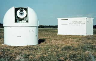 Here is a predeployment view of the components--a camera observing dome and an instrumentation shelter. The dome was open only while observations were being acquired. The instrumentation shelter, containing timing, communications, and other electronic equipment, is shown in the background. The equipment was transported on a trailer and set in place with a crane. For a sense of scale, the photo on this page depicts the camera dome and instrument shelter stored in front of Bio (NOAA original photo). |
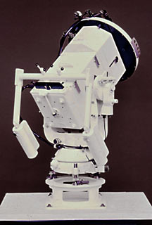 Here's a view of the camera, manufactured by Wild, in Heerbrugg, Switzerland, specially for photographing satellites. The original BC-4 had a 350 mm focal length while the modified camera used in the PAGEOS program had a 450mm focal length (NOAA original photo). |
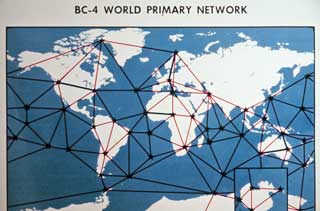 Here's a map of many of the earlier stations. Since this was the height of the Cold war, there is a significant gap in coverage (NOAA original photo). |
 A diagram showing how how locations could be triangulated by taking photographs from 3 stations at once (NOAA original photo). |
|
The equipment was moved from station to station over the years, so that cameras were positioned so that at least 3 of them could see and photograph the satellite simultaneously. The project worked, but...it wasn't accurate enough for what folks really wanted. Traditional celestial navigation was accurate to +/- 400 meters, which was more than adequate for the open ocean, but not for (say) aiming of ballistic missiles. The PAGEOS project proved accurate to +/- 10 meters. The doppler satellite program (which came next) was accurate to about 5 meters, and the present GPS system has evolved to centimeter accuracy. PAGEOS was slow, since the photographic plates had to be sent in to the headquarters office for processing. In addition, the system (unlike celestial navigation) was not generally accessible to the common user...that feature as well would have to wait for GPS. | |
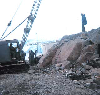
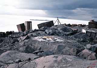 Before the equipment was positioned, a fair amount of survey work was required. The team also did a geodetic survey of the station environs, which may be what is going on here (NOAA original photo). |
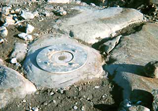 Another of the project survey markers. I remember seeing these while exploring a snow-free backyard, but from this time and distance I can't determine where the equipment was actually positioned (NOAA original photo). |
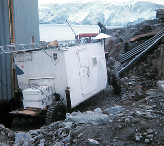 It took some careful maneuvering to get the instrumentation shelter around behind GWR (NOAA original photo). |
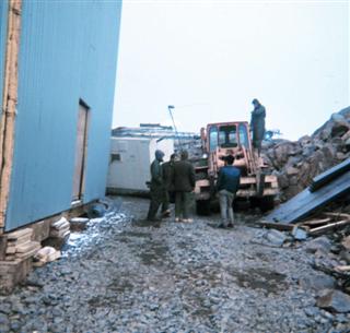 Turning the corner. The incomplete door opening is the exterior door to USARP supply, on the backyard end of GWR (NOAA original photo) (which is flipped). |
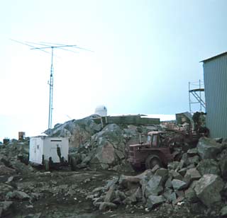
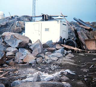 Here's the instrumentation shelter in place, with the camera dome in the background (NOAA original photo). |
|
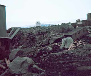 Another view of the camera dome from behind GWR. The equipment became operational on 27 February; the photography operations had to be done in darkness (NOAA original photo). |
|
|
All of these photos are from the NOAA photo archive, specifically from the geodesy collection, taken by one of the four U. S. Army Topographic Command folks, Edward J. Davis, David R. Messent, John H. Page, and John E. Webb, who wintered in 1969 dealing with the PAGEOS project (note that the color quality of the original slides was poor, and I've done my best to enhance them here, and I've linked to the original photos). Note that Palmer was Station 050 for this project. The satellite test inflation photo is this NASA image. Another NASA program reference is "The Fabrication and Testing of PAGEOS I" by Louis A Teichman, Langley Research Center, 1968; and there is also brief mention of the project in the May/June 1969 Antarctic Journal. Other references include Wikipedia, this Australian page describing the project, and "A new look at planet Earth: Satellite geodesy and geosciences", a 2001 paper by François Barlier and Michel Lefebre. | |
